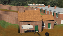
In the summer of 1831, The Board of Visitors approved one “office” to be built “in the rear of the Hotel assigned to the fourth Hotel-keeper,” which most likely refers to Hotel D.[1] In 1844, the Board of Visitors had “cause to be erected at some convenient spot on the grounds of the University near the Hotel occupied by Mrs. [Margaret C.] Ward a wash house necessary for her additional accommodation.”[2] At the time, Mrs. Ward was taking over Hotel D after the death of her husband, William.
Structure 2 appeared earliest in the 1849 lithograph University of Virginia From the East by P. S. Duval. The building’s eastern gable end is shown with one window in the upper story and two windows in the lower. This building appears again in the 1856 engraving of the Academical Village from the west by Casimir Bohn as a square, one-story, gable-roofed structure with a chimney located in the center of its western wall. There are no doorways or windows shown in the western wall. In a Sanborn Insurance Map from 1891, Structure 2 is indicated as a two-story dwelling. A brick pathway connecting the rear of Hotel D to Structure 2 was found during the archaeological excavation led by Donald Parker in 1960, suggesting the two buildings’ close relationship.
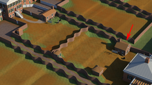
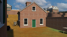
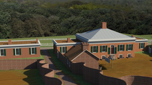
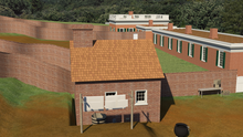
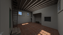
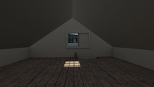
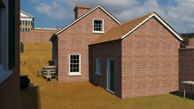
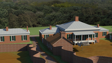
Because of limitations of the site, Rivanna Archaeological Services was only able to excavate the southeast corner of the building. Built into the eastern garden terrace of Hotel D, the foundation of Structure 2 penetrated deep into the ground and acted as multiple retaining walls. It was also found that the floor of Structure 2 was two feet below grade compared to Hotel D. Material culture discovered at the site included a metal pot, buttons, glassware, and animal bones, suggesting that the building’s function was as a kitchen and laundry. Based on engravings, maps, and archaeological reports, Structure 2 was digitally reconstructed as a one-and-a-half story gable-roofed building with its first floor being 2 feet lower than the entrance.
The Kugino map of the University from 1895 shows an altered Structure 2 behind Hotel D while the 1909 topography map by Laird and Jackson does not show Structure 2, suggesting that the building was demolished sometime in between- possibly during implementation of McKim, Mead and White’s master plan after the Rotunda fire and the creation of the East Lawn Road.
|
Structure 2 behind Hotel D, aerial view |
Structure 2 behind Hotel D |
Structure 2 behind Hotel D seen from... |
|
Structure 2 behind Hotel D seen from... |
Structure 2 Interior view shows working... |
Structure 2 second floor space |
|
Structure 2 behind Hotel D with 1844... |
Structure 2 with 1844 addition seen... |
Structure 2 with 1844 addition seen... |
